Details
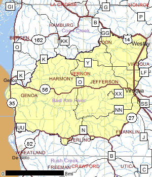
The Bad Axe River Watershed, which lies entirely within Vernon County, encompasses approximately 200 square miles of steep forested hillsides, ridge top and valley farms. The only farms with sizable tillable acreage in the basin are located on the upper plateau of the Bad Axe River watershed, west of Westby and Viroqua. The communities of Viroqua, Westby and Genoa are all found within this watershed.
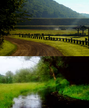
Excessive flooding of the Bad Axe River watershed in the 1950s and 1960s prompted the construction of many flood control structures on numerous streams. Some of these structures are designed to permanently detain water (wet dam) while many others impound water only during rain events (dry dam) then slowly release it over time. Vernon County is responsible for maintaining many of these flood control structures. These structures were put to the test in August 2007 and again in June 2008. What has been called the 1,000 year flood occurred on August 18, 2007. All 8 flood control structures in the Bad Axe River watershed were damaged. Saturated soils on hillsides slumped and created mudslides, bridges and culverts were washed out, roads were flooded, and flood control structures were stressed to their limits. Emergency spillways were compromised at many dams in Vernon County. The waters behind the dam located on the Springville Branch of the Bad Axe River reached its concrete emergency spillway, which was an historic event.
Past land use of the steep terrain in this watershed contributed to the reshaping of the land and water resources. Soil washed off hilltops and hillsides down to the streams, which filled floodplains and gave streams no where to go with high water. The streams, having to find their new equilibrium, cut down through these long ago eroded soils creating streams creating vertical streambanks and no floodplain to speak of. Trout stamp funds have been used over the last 33 years to reshape many of these streambanks through movement of soil and planting of grasses, effectively giving the streams access to a new floodplain. After the floods of 2007and 2008, those segments of stream where streambank work was done showed no catastrophic changes compared to those segments without reshaped and planted streambanks. Very little repair of the previous streambank work was necessary.
Date 2010
Nonpoint and Point Sources
The Vernon County Natural Resources Conservation Service (NRCS) is currently administering an Environmental Quality Incentives Program (EQIP) project in this watershed. The main focus of this effort is to reduce gully and streambank erosion in the Bad Axe River Watershed. This project requires landowners to sign up in order to be considered for streambank or gully erosion projects on their property. The Bad Axe River Watershed EQIP project has signed up 92 landowners for projects over the last four years. After three construction seasons, this project has improved 30,837 feet of streambank with shaping, riprap and LUNKER structures, which has saved an estimated 9,839 tons of soil from washing into streams. A total of 120 gullies have been stabilized with dams, grassed waterways, critical area shaping and seeding, saving approximately 8,375 tons of soil from reaching streams. [DNR-Cindy Koperski]
Viroqua WWTP Study
Above the large spring that provides the initial flow for the Springville Branch Bad Axe River, the stream channel is a dry run classified as limited aquatic life in ch. NR 104. Below the spring, the Springville Branch managed as a Class I trout stream. This study involves evaluating various alternatives for wastewater effluent from the city of Viroqua. The city operates a 0.600 million gallons per day (MGD) wastewater treatment facility that discharges to the Springville Branch of the Bad Axe River. The wastewater effluent flows over karstic rock (an area of irregular limestone in which erosion has produced fissures, sinkholes, underground streams, and caverns) for approximately 2.75 miles upstream of the Springville spring. Investigations by the WDNR and the City have determined that the vast majority of the wastewater is lost to groundwater either through swallets or flow directly over exposed fractured bedrock prior to reaching the spring. Discharge of treated wastewater into fractured bedrock is an unacceptable practice. Alternatives include:
1. Treating effluent to groundwater standards.
2. Piping the effluent to surface water.
3. Constructing a catchment structure upstream of exposed bedrock and piping normal stream flow past
the area of exposed bedrock to surface water.
4. Modify the streambed to reduce infiltration
A solution to how to treat or route the effluent of the Viroqua WWTP will be decided before the next permit term. Winter Manure Runoff Study, Conducted in 2007 Department staff monitored various floages and main stem tributaries to understand and document agricultural runoff entering the flowages during active snowmelt events or winter rain events. The study design includes collecting pre-runoff data from all flowages and their main stem tributaries. Dissolved oxygen and temperature profiles in the impoundments were conducted approximately every three weeks to document stratification prior to a runoff event. Water chemistry samples were collected in the zone of anoxia (or no oxygen) -- if found -- to understand and document water quality conditions prior to runoff.
Date 2002

Ecological Landscapes
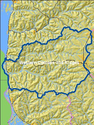
This watershed is located in the Western Coulee and Ridges Ecological Landscape in southwestern and west central Wisconsin and is characterized by its highly eroded, driftless topography and relatively extensive forested landscape. Soils are silt loams (loess) and sandy loams over sandstone residuum over dolomite. Several large rivers including the Wisconsin, Mississippi, Chippewa, Kickapoo and Black flow through or border the Ecological Landscape.
Historical vegetation consisted of southern hardwood forests, oak savanna, scattered prairies, and floodplain forests and marshes along the major rivers. With Euro-American settlement, most of the land on ridgetops and valley bottoms was cleared of oak savanna, prairie, and level forest for agriculture. The steep slopes between valley bottom and ridgetop, unsuitable for raising crops, grew into oak-dominated forests after the ubiquitous presettlement wildfires were suppressed. Current vegetation is a mix of forest (40%), agriculture, and grassland with some wetlands in the river valleys. The primary forest cover is oak-hickory (51%) dominated by oak species and shagbark hickory. Maple-basswood forests (28%), dominated by sugar maple, basswood and red maple, are common in areas that were not subjected to repeated presettlement wildfires. Bottomland hardwoods (10%) are common in the valley bottoms of major rivers and are dominated by silver maple, ashes, elms, cottonwood, and red maple. Relict conifer forests including white pine, hemlock and yellow birch are a rarer natural community in the cooler, steep, north slope microclimates.
Date 2010
Hydrologic Features
Excessive flooding in the Bad Axe River watershed in the 1950s and 1960s prompted the construction of many flood control structures on numerous streams. Some of these structures are designed to permanently detain water (wet dam) while many others impound water only during rain events (dry dam) then slowly release it over time. Vernon County is responsible for maintaining many of these flood control structures. These structures were put to the test in August 2007 and again in June 2008. What has been called the '1,000 year flood' occurred on August 18, 2007. All 8 flood control structures in the Bad Axe River Watershed were damaged.
Saturated soils on hillsides slumped and created mudslides; bridges and culverts were washed out; roads were fl ooded; and flood control structures were stressed to their limits. Emergency spillways were compromised at many dams in Vernon Count y. The waters behind the dam located on the Springville Branch of the Bad Axe River reached its concrete emergency spillway, which was an historic event. Bad Axe River watershed resulting in over fl ow to their emergenc y spillways. Destructive scour by the excess water required extensive repair. The waters behind the Bad Axe 11 Duck Egg dam (on the Springville Branch of the Bad Axe River) reached a height never before recorded.
Past land use of the steep terrain in this watershed contributed to the reshaping of the land and water resources. Soil washed off hilltops and hillsides down to the streams, which fi lled the fl oodplains -- and gave streams nowhere to go with high water. The streams, having to fi nd their new equilibrium, cut down through these long ago eroded soils creating streams with vertical streambanks and no vir tually floodplain.
Trout stamp funds have been used over the last 33 years to reshape many of these streambanks through movement of soil and planting of grasses, effectively giving the streams access to a new fl oodplain. After the floods of 2007 and 2008, those segments of streams where streambank work was done showed no catastrophic changes compared to those segments without reshaped and planted streambanks. Very little repair of the previous streambank work was necessary.
Steep hillsides became unstable with the excessive rain and many slumped or slid down to the lowest spot destroying some buildings and roads in the process (See photo upper right). Many stream miles and structures were unharmed due to the eff ectiveness of these flood control structures during both the 2007 and 2008 flood events.
Date 2010
Recreational Opportunities
Major Public Lands in the Bad Axe LaCrosse Watershed include the Upper Mississippi River Fish and Wildlife Refuge, Sidie Hollow County Park, Duck Egg County Park, and Esofea County Park.
Recreational parks surround two flood control structures: Sidie Hollow County Park on Sidie Hollow Creek and Coe Hollow Creek and Duck Egg County Park on the Springville Branch. miles of designated trout streams exist in the watershed. Many of these trout streams also have streambank easements owned by the Wisconsin DNR which allow angler access.
Generally, the North Fork of the Bad Axe River contains warmer water than the South Fork; consequently more of the South Fork is classified as trout water. However, the North Fork contains a very diverse fishery below Runge Hollow Lake. The shift in agricultural land to recreational land that is taking place in the Bad Axe River Watershed is a regional phenomenon happening throughout other parts of rural Wisconsin.
Date 2010
Fisheries
Generally, the North Fork of the Bad Axe River contains warmer water than the South Fork, consequently more of the South Fork is classified as trout water. However, the North Fork contains a very diverse fishery below Runge Hollow Lake. The Bad Axe River only totals five miles in length and contains a fishery more similar to the Mississippi River rather than the North and South Forks that feed it. Many miles of trout streams are located in the Bad Axe River watershed
Date 2010
River and Stream QualityAll Waters in WatershedThe Bad Axe Watershed's streams are generally in good condition.
There are 35 miles of Class I trout streams in the watershed including: Bad Axe River Springville Branch, Norwegian Hollow Cr., Coe Hollow Creek, Frohock Creek (Creek 15-14), and Hornby Creek. Two additional streams arWaters recently monitored and found to be in overall good condition include Coe Hollow Creek, Bad Axe River, Springville Branch, Bad Axe River, Hornby Creek, Runge Hollow Lake, and Sidie Hollow Creek. Two waters were indicated as possibly fair condition with a possible need for more monitoring: Esofea Branch and Sidie Hollow Lake. The only impaired water in this watershed is the Mississippi River, which forms the western edge of the land area. Class II Trout waters, meaning some propagation occurs, but the streams are partially self-sustaining: Esofea Branch, Sidie Hollow Creek, and there are about 28 miles of Class III trout waters, which do not exhibit natural reproduction: an Unnamed stream, South Fork Bad Axe River, and Cox Creek.
Waters recently monitored and found to be in overall good condition include Coe Hollow Creek, Bad Axe River, Springville Branch,,Bad Axe River, Hornby Creek, Runge Hollow Lake, and Sidie Hollow Creek. Two waters were indicated as possibly fair condition with a possible need for more monitoring: Esofea Branch and Sidie Hollow Lake. The only impaired water in this watershed is the Mississippi River, which forms the western edge of the land area.
Outstanding and Exceptional Resource Waters
The Bad Axe Watershed's streams are generally in good condition, with the following three exceptional resource waters in the Vernon County: Cox Creek, 5.79 miles, Hornby Creek, 9.59 miles, and Frohock Creek (Creek 15-14), 5.24 miles.
Trout Streams
There are nearly 90 miles of classified trout streams in the Bad Axe River Watershed. Many segments of these streams have been improved with in-stream habitat work using the Wisconsin Inland Trout Stamp funds. Also, many miles of Wisconsin DNR streambank easements also exist on many of these trout streams. There are 35 miles of Class I trout streams in the watershed including: Springville Branch of the Bad Axe River, Norwegian Hollow Cr., Coe Hollow Creek, Frohock Creek (Creek 15-14), and Hornby Creek. Two additional streams are Class II Trout waters, meaning some propagation occurs, but the streams are partially self-sustaining: Esofea Branch of the North Fork Bad Axe River, Sidie Hollow Creek, and there are about 28 miles of Class III trout waters, which do not exhibit natural reproduction: an Unnamed stream, South Fork Bad Axe River, and Cox Creek.
Date 2010
Watershed Trout StreamsWatershed Outstanding & Exceptional ResourcesLakes and Impoundments
Sidie Hollow Lake is one of the few lakes in this watershed. Sidie Hollow is 35.07 Acres, with a maximum depth of 22 feet. This lake was assessed for Fish and Aquatic Life uses in 2009 and considered "fair" based on satellite derived trophic state index data. The lake is considered "eutrophic". Historical reports indicate that Sidie Hollow Lake is an impoundment constructed under the PL-566 conservation program. In the 1970's the water was clear, hard, alkaline, and considered to have moderate transparency. Today the lake is documented as "murky", although it connects with a class II trout water.
Additional lakes include Runge Hollow Lake, Wallter Lake and Esofea Pond.
Date 2010
Wetland Health
Wetland Status
The Bad Axe LaCrosse Basin, in the driftless area of the state, has few wetland resources. Only about 2% of the current land uses in the watershed are wetlands. However, 81% of original wetlands in the watershed are estimated to exist. Of these wetlands, the majority are forested wetlands (51%) and emergent wetlands (40.9%) which include marshes and wet meadows.
Wetland Condition
Little is known about the condition of the remaining wetlands but estimates of reed canary grass infestations, an opportunistic aquatic invasive wetland plant, into different wetland types has been estimated based on satellite imagery. This information shows that reed canary grass dominates 77% of the existing emergent wetlands and 18% of the remaining forested wetlands. Reed Canary Grass domination inhibits successful establishment of native wetland species.
Wetland Restorability
Of the 533 acres of estimated lost wetlands in the watershed, approximately 90% are considered potentially restorable based on modeled data, including soil types, land use and land cover (Chris Smith, DNR, 2009).
Date 2010
Potentially Restorable Wetland AnalysisImpaired Waters
The Mississippi River's Pool 9 [(Mississippi (Reach 4) Coon-Yellow - Pool 9 portion - LD 9 to LD 8))] considered part of this watershed, is on the state's impaired waters list for Contaminated Fish Tissue, Water Quality Use Restrictions due to polychlorinated biphenyls (PCBs) and Water Quality Use Restrictions due to ambient Mercury concentrations in the water column.
Date 2010
List of Impaired WatersAquatic Invasive Species
A few aquatic invasive species have been documented in the watershed, including Curly Leaf Pondweed on Coe Hollow Creek, Runge Hollow Lake, Sidie Hollow Lake, and North Fork Bad Axe River. Eurasian Watermilfoil is found on Runge Hollow Lake, North Fork Bad Axe River, and Esofea Branch. Rusty Crayfish is found in Springville Branch.
Date 2010
Monitoring & ProjectsProjects including grants, restoration work and studies shown below have occurred in this watershed. Click the links below to read through the text. While these are not an exhaustive list of activities, they provide insight into the management activities happening in this watershed.
Monitoring Studies
Several monitoring studies are underway in the Bad Axe LaCrosse Basin. One study which has been ongoing since 2008 is the an analysis of treatment options and impacts for the Viroqua Wastewater Treatment Plant. Viroqua is a 4 square mile city located at the headwaters of the Springville Branch of the Bad Axe River and Sidie Hollow Creek. The city of Viroqua operates a 0.600 MGD wastewater treatment facility that discharges to the Springville Branch of the Bad Axe River. The wastewater effluent flows over karstic rock for approximately 2.75 miles above the Springville spring. Above the Springville spring, the Springville Branch is a dry run channel classified as limited aquatic life in ch. NR 104. Below the spring, the Springville Branch of the Bad Axe River is managed as a Class I trout stream.
Investigations by the department and the City have determined that the vast majority of the wastewater is lost to groundwater either through swallets or flow directly over exposed fractured bedrock prior to reaching the spring. Discharge of treated wastewater into fractured bedrock is an unacceptable practice and during the next permit cycle actions will need to be taken to remedy the situation.
A study of winter manure runoff was conducted to determine impacts to flowages and mainstem tribuary waters including: Big Eau Pleine Flowage (Central Wisconsin Basin), Spirit Flowage (Head Waters Basin), Lake Tomah (Lower Wisconsin Basin), Runge Hollow Lake (La Crosse Bad Axe Basin), Sidie Hollow Lake (La Crosse Bad Axe Basin), Hillsboro Lake (Lower Wisconsin Basin).
In addition, ice observations, aquatic invasives monitoring, and Citizen Lake Management Network montioring is ongoing at Sidie Hollow Lake.
Date 2010

Goals
3/10/2010
Water Quality Goals for the Watershed Include:
Conducting comprehensive stream surveys on impaired or potentially impaired streams; Installation of in-stream habitat where habitat is a limiting factor for biological condition, and Continued work in conducting continuous water temperature monitoring on key streams where temperature may be a limiting factor for biological response.
Priorities
8/14/2010
Priority issues for this watershed include the quantity and quality of stormwater reaching surface waters, and the impacts on surface water temperature from stormwater water runoff. A related but distinct priority is identifying and reducing urban and agricultural nonpoint source pollution in addition to stormwater runoff.
Watershed RecommendationsVernon County NOD
Date
Status
This project is a landowner installation of nonpoint source best management practices to contribute to the restoration of Wisconsin's waters and was funded by the 319 grant.
6/4/2018
In Progress
Vernon County Nonpoint Source BMPs
Date
Status
This project is a landowner installation of nonpoint source best management practices to contribute to the restoration of Wisconsin's waters and was funded by the 319 grant.
6/4/2018
In Progress
Springville Branch fishery restoration
Date
Status
The Springville Branch fishery would benefit from the removal of beaver dams, the reduction of non-point source
pollution and the continued proper operation of the Viroqua Wastewater Treatment Plant.
7/1/2010
Proposed
The South Fork of the Bad Axe River
Date
Status
The South Fork of the Bad Axe River fishery would benefit from the reduction of streambank erosion.
1/1/2010
Proposed
Volunteers for Coe Hollow Creek, Sidie Hollow
Date
Status
Coe Hollow Creek, Sidie Hollow
1/1/2010
Proposed
Date
Status
The Cox Creek and Frohock Creek fisheries would benefit from improved in-stream habitat.
1/1/2010
Proposed
North Fork Bad Axe River
Date
Status
The North Fork Bad Axe River would benefit from the in stream river restoration.
1/1/2010
In Progress
Sidie Hollow Lake Grants
Date
Status
Coe Hollow Creek, Sidie Hollow Lake Grants
1/1/2010
Proposed
North Fork Bad Axe River, Runge Hollow Lake
Date
Status
1641700 North Fork Bad Axe River
1642400 Runge Hollow Lake
1/1/2010
Proposed
Monitor biology on WBIC: 3000300
Date
Status
Conduct biological (mIBI or fIBI) monitoring on Unnamed, WBIC: 3000300, AU:1523341
5/21/2016
Proposed
Biological Monitoring, WBIC 1639300
Date
Status
Conduct biological monitoring, wbic 1639300 to evaluate TP impacts
7/5/2011
Proposed
Date
Status
A fish and habitat survey should be conducted on Bull Run to update biological and physical data
1/1/2011
Proposed
Coe Hollow Creek, Sidie Hollow Lake Grants
Date
Status
Coe Hollow Creek, Sidie Hollow Lake Grants
1/1/2010
Proposed
Date
Status
WDNR staff should continue to encourage communities to develop wellhead protection plans in the Watershed and the whole basin.
7/1/2010
Proposed
Date
Status
Beach closings due to unsafe bacterial levels in rivers and in some impoundments are of concern. Due to the topographic constraints of many farms in the basin, many barnyards and feedlots are immediately adjacent to streams. If not properly managed, these areas can contribute large amounts of bacteria laden manure to a stream.
1/1/1960
Proposed
Date
Status
The City of Viroqua should pursue a stormwater management plan for their community.
8/14/2010
Proposed
Date
Status
Increased runoff volumes from expanding urban areas in the basin threaten not only the quality but also the future existence of adjacent trout streams. The change in stormwater runoff volume as well as when and how much of it reaches an adjacent stream can degrade the in-stream habitat and water temperatures necessary for trout survival.
1/1/1960
Proposed
Sewer Service Area Planning LaCrosse River Area
Date
Status
Development encroaching into the extensive lower La Crosse River wetland complex threatens not only the flood control function, but also the diversity of plant and animal species residing within. Requests to fill one acre here and a half acre there of the La Crosse River marsh contributes to the cumulative reduction in total area.
1/1/1960
In Progress
 Water Plans and PartnershipsRead the Watershed Plan
A watershed plan has been updated for this watershed in 2010 and is now available.
Date 2010
Watershed History NoteVernon County is set in the driftless southwestern corner of Wisconsin; an area that was untouched by the receding glaciers 15,000 years ago and thus an area of deep carved valleys, or coulees, drained by hundreds of cold-water streams, was left. The hilly terrain includes the Ocooch Mountains. Ocooch is a Native American word meaning waters with many fish.
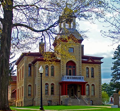
Vernon County was originally named Bad Axe County, but was renamed Vernon County in 1862. The largest city in the county, and also the county seat, is Viroqua, with a population of 4,400. The Downtown District of the city was named to both the Wisconsin and National Register of Historic places in 2003 due to the merits of the buildings in the district which are largely intact.
Viroqua is the center of one of the greatest organic farming regions in the United States and each Saturday from late May to late October, the Farmers Market is a lively and busy place full of colorful produce. Local Amish families also sell their handmade wooden items and beautiful rugs and quilts.
The city of Westby is located in the northeast corner of the watershed. Westby was named after general store owner and Civil War Union soldier, Ole T. Westby, of Biri Norway. Many Norwegians settled in the area and the local economy was built on agriculture, with a strong tradition of cooperative businesses. With seven cooperatives still functioning, Westby has been referred to as "Co-op City".
Sources: http://viroqua-wisconsin.com, http://www.viroquatourism.com/index.html,
http://www.co.vernon.wi.gov
Date 2010